Geoviewer RNDT 2.0
Geoviewer RNDT
Visualizzatore per risorse geografiche disponibili sul Web.
Published by Agenzia per l'Italia Digitale
Software maintained by RTI Fastweb - Leonardo - SIA (sub-contractor ESRI Italia)
Vitality:
46%
The vitality index, as explicited in the guidelines for the acquisition and reuse of software for Italian PA, is calculated according to the following four main categories:
- Code activity: the daily number of commits and merges;
- Release history: the daily number of releases;
- User community: the number of unique authors;
- Longevity: the age of the project.
The ranges of every measure can be found in the vitality-ranges.yml file.
Development status: stable
Software functionality
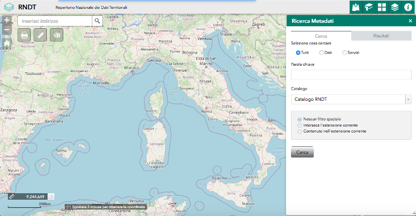
Visualizzatore che permette di ricercare e visualizzare risorse geografiche disponibili sul Web.
detailed information
Geoviewer RNDT 2.0
Geoviewer RNDT
Last release 2020-06-21 (2.0)
Type of maintenance contract
Stato publiccode.yml
Contract with RTI Fastweb - Leonardo - SIA (sub-contractor ESRI Italia) until the 2021-08-04
License EUPL-1.2
Platforms
windows
linux
ios
mac
List of dependencies None
Enabling platforms None
Compliance None
Supported languages
Italian
Extended description
Geoviewer RNDT è una soluzione che consiste in un visualizzatore che permette di ricercare e visualizzare risorse geografiche disponibili sul Web.
Il visualizzatore permette di effettuare sovrapposizioni di servizi mappa (REST, WMS, WFS) e di file Shapefile, CSV, GPX o GeoJSON, oltre a ricerche nel catalogo di metadati. Include un servizio di geocodifica oltre a una galleria di mappe di base.
Una installazione funzionante è il geoviewer disponibile nel portale RNDT.
